
Walk a St. Charles Street Directory Address
A St. Charles street directory search begins with geography, not a name list. County GIS can place an address on a parcel and show the surrounding map layers. The Assessor card then supplies the assessment owner, property address, mailing address, account or map identifier, legal description, structure details, and district fields. Those fields describe the parcel. They are not a current household roster, and a mailing address can belong to a lender, trust, business, or an owner who lives elsewhere.
For each address, the St. Charles street directory method keeps the parcel identifier with the map result before moving to a different office. That record trail is more reliable than broadening a name search until it produces unrelated people.
Keep a row for each parcel when working along a street. Record the query spelling, situs address, parcel or account number, legal description, postal city, ZIP, municipality, assessed owner, and latest deed instrument. This makes it possible to see when one road crosses into a different city or unincorporated area. It also prevents a long St. Charles street from becoming an unlabeled collection of names.
- Enter the address in St. Charles County GIS Mapping, select the mapped parcel, and copy the parcel or account identifier and legal description.
- Check the County Assessor card for the assessed owner, while keeping the mailing address separate from the situs or physical property address.
- Use the parcel, street address, or legal description in the Recorder search to identify the latest deed and its recorded parties.
- For limited election information, ask the Election Authority what precinct or district record may lawfully be inspected or requested for the relevant election and date.
- For an older address, compare a dated reverse or criss-cross directory entry with census, deed, newspaper, or obituary evidence.
Note: Parcel ownership, a tax contact, and a historical directory entry answer different questions and should be dated rather than merged into one claim.
St. Charles Street Directory Records by Address
Several St. Charles County records can be reached with an address, but each has a narrower purpose. The Assessor and GIS establish the parcel. The Recorder supplies a legal transaction trail. City permits and code records can document an agency event at a service address. Historical maps show the built setting, rather than proving an occupant. Use the record that matches the question and retain its access limits.
| Address record | County or city keeper | Useful street detail | Available access |
|---|---|---|---|
| Assessment card | St. Charles County Assessor | Assessed owner, mailing and situs fields, parcel, legal description, value, structure, and districts | Property portal, phone, or counter. Live control details were not available during research. |
| GIS parcel | County GIS Services | Mapped parcel, ZIP, postal city, incorporated or unincorporated community, districts, aerials, and reference layers | Free county map and map services |
| Deed, lien, or mortgage | Recorder of Deeds | Grantor, grantee, date, document number, legal description, and associated documents | Free office terminal, paid Tapestry, Laredo subscription, or copy request |
| Plat or survey | Recorder of Deeds | Subdivision, lot, block, lines, and dimensions | Recorder counter and copy service; some records are paper or mylar |
| Permit or code case | St. Charles City Community Development | Permit type, number, service address, inspection, or enforcement event | Public permit search, request, or call. Detailed case search was not located. |
A parcel number ties the first three sources together more reliably than a street label alone. Street names, suffixes, house numbers, postal cities, and municipal lines can change or differ. A legal description can remain useful even when the address form does not.
Map a St. Charles Street Before Searching
The county GIS map is the practical first stop for a St. Charles street search. Enter an address, zoom to the feature, select the parcel, and inspect the available information. The address service includes ZIP, ZIP+4, postal city, incorporated municipality, unincorporated community, street and city-code fields. That combination helps explain why a mailing or delivery city does not always match the city government that keeps permit or code records.
Turn on only the layers needed for the question. County map materials describe planning and zoning, voting, council, school and utility, flood, historic-district, aerial, parks, public-safety, and general-reference layers. The county also describes distance estimates and current or historical aerial comparison. GIS is best for defining the street and parcel geometry. It should not be used to infer private residents from a map point.
| GIS control or layer | How it helps a street search |
|---|---|
| Address search | Finds and zooms to a mapped address. |
| Parcel select | Opens parcel information and shows neighboring geometry. |
| Layer list | Adds parcels, zoning, voting, schools, utilities, flood, historic districts, aerials, and general reference. |
| Identify or query | Returns feature attributes; exact live labels were not confirmed. |
| Measure | Supports distance estimates described by the county. |
Read a St. Charles Street Assessor Card
The St. Charles County Assessor Property Database is the current parcel route. County-linked materials identify Account, Street, City, ZIP, Property Type, Parcel ID or Map ID, Year Built, Square Footage, and Owner Name as fields or filters. Research could not inspect the live form because Cloudflare blocked it, so required fields, partial-match behavior, whole-street browsing, and result limits should be verified in the live portal before relying on them.
| Observed Assessor field | Type | Required | Verified use or caution |
|---|---|---|---|
| Account or Parcel ID | Text | Not located | Use the county account or map identifier from the parcel card. |
| Street or Property Address | Text | Not located | Use the situs address route; live matching rules were not located. |
| Owner Name | Text | Not located | Current assessment-owner path; exact and partial matching were not verified. |
| City and ZIP | Text or select | Not located | Helpful locality fields, but USPS label and municipal boundary can differ. |
| Property Type, Year Built, Square Footage | Select or numeric | Not located | County-linked parcel materials report these categories; verify the live controls. |
The key distinction is mailing versus situs. Mailing is the tax-correspondence address. Situs is the physical parcel location used for mapping and address searches. Neither field establishes who is present at the property. Assessment changes can also lag a recorded transfer.
- Parcel
- A mapped property unit identified by an account, map, or parcel number in county land records.
- Situs address
- The physical address of the parcel, as distinct from the address used for tax correspondence.
- Plat
- A recorded map showing a subdivision, lots, blocks, lines, or dimensions. It answers a layout question, not an occupancy question.
- Criss-cross directory
- A dated directory arranged by street and number, when a volume actually uses that arrangement. Verify the volume type and its abbreviation key.
St. Charles Street Deeds and Plats
After the parcel is identified, the Recorder converts it into recorded documents. St. Charles County Land Records lists deeds, mortgages, liens, plats, and surveys. Laredo search tips permit address, parcel number, subdivision, lot and block, section-township-range, book and page, document number, recording date, and party searches. If the address returns no match, use the legal description rather than broadening a party search until unrelated results appear.
The Recorder provides free public research on the third floor Monday through Friday from 8:00 a.m. to 4:30 p.m., with prints at $1 per page. Tapestry is a pay-per-search service, while Laredo is subscription access. The Recorder accepts walk-in, mail, and e-recording services, but those services are separate from public research. Start at the counter to locate an instrument number or book and page, then ask for the needed image or copy type.
The Recorder's Land Records page is the source for the free counter, Tapestry, and Laredo options pictured here.
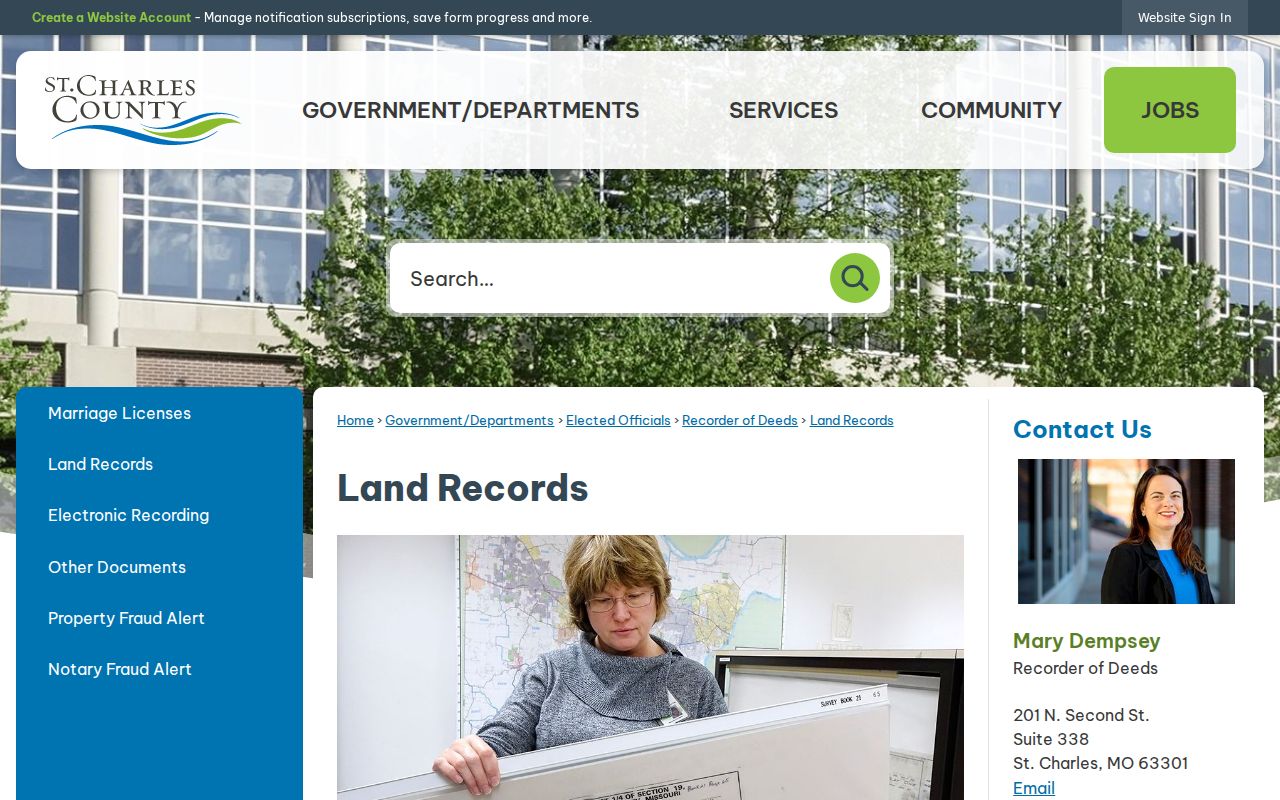
Use the image as an access reminder, then confirm the current option and any remote charge with the Recorder before ordering a copy. A record result can include multiple legal descriptions or associated documents, so review the instrument rather than treating one row as the full property history.
Note: Laredo's index begins January 1, 1972, while its agreement describes images from November 16, 1804, so older material may still require index books or microfilm.
St. Charles Street Permits and Code Files
For an address in the City of St. Charles, the public permit search exposes Permit Type, Permit Number, and Service Address as observed search controls. A permit can place a construction, addition, sign, or inspection event at a property. Coverage dates, result caps, fees, and whether an owner or applicant appears in a detailed result were not verified. Treat it as dated property evidence, not a resident list.
Code Enforcement handles property-maintenance, zoning, sign, investigation, and inspection matters. A detailed online case lookup was not located. Call Community Development at 636-949-3222 or use the Code Enforcement request path for a record question. First check the GIS incorporated-municipality field. A St. Charles postal address can fall outside the City of St. Charles and may belong with another city department or an unincorporated county custodian.
St. Charles Street Voter File Limits
Missouri's public voter extract may include permitted name, year-of-birth, street-address, and district fields, but the online voter outreach tool is an identity-confirmation service. It asks for registered first and last name, date of birth, last four digits of a Social Security number, and county. It is not a free street roster. Full dates of birth, Social Security numbers, and ballot choices are not public outputs.
The St. Charles County Election Authority is the local custodian for broader file requests and public-inspection questions. Ask for the election or date range, precinct or district scope, desired fields, delivery format, and current fee or redaction rules. Registers can be inspected at reasonable times under Missouri law, subject to election-use and security rules. Safe at Home and other protected-voter measures can withhold or substitute an address.
St. Charles Street Postal-City Checks
St. Charles County geography has more layers than a street line. GIS can show postal city, ZIP, incorporated municipality, and unincorporated community for the same mapped address. A postal city is a delivery label, not a government boundary. For example, official county material documents 63366 with O'Fallon and St. Paul, and 63304 with Cottleville and Weldon Spring. City permits, code requests, and district layers should follow the applicable local government, not the ZIP alone.
When an address search misses, test directional prefixes, suffixes, street-type abbreviations, historic labels, an old number, and the postal-city form. If GIS finds the parcel but the Recorder does not, copy the parcel or legal description into the Recorder search. That stable land key is less likely to be affected by an address-format mismatch.
St. Charles Street History and Family Clues
Past St. Charles addresses can reconnect a family story when the deed trail ends with a different owner or an estate. The St. Charles City-County Library's genealogy services include local-history collections, licensed directory and census resources, and library access to FamilySearch. The St. Charles County Historical Society holds more than 200 years of property, probate, obituary, newspaper, map, plat-book, and family materials. Its research service is a useful fallback because not all indexes are online.
A reverse or criss-cross directory can connect a street number to a dated entry, but exact local directory years were not verified in an official online catalog. Confirm the holding, publisher, year, scope, and abbreviation key with the library or Society. Pair the entry with census, a recorded deed, obituary, probate, or newspaper evidence. The St. Charles Directory Book has the collection-focused route for that work.
Limits of the St. Charles Street Directory
A street directory can identify a public parcel, an assessment owner, a recorded party, a dated directory listing, or limited election information obtained through the correct channel. It cannot reveal all household members, nonowner occupants, utility customers, delivery records, protected residents, or closed driver-license address data. A tax mailing address is a correspondence clue, not proof that someone lives at the situs address.
A St. Charles street directory is strongest when it reports the kind and date of each public record, rather than suggesting that a parcel result names everyone at a home.